TFL partnered with onX Offroad to help us navigate across the U.S. as part of our No Pavement Needed: TransAm Trail series that kicks off later this year. It’s a good thing we did as it takes the guesswork out of navigating on trails and dirt roads where there’s no cell service. Plus the powerful app negates the need for a separate GPS device.
onX Offroad – Trail Tested
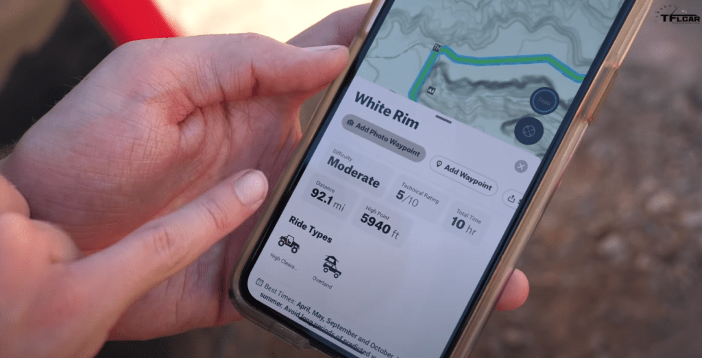
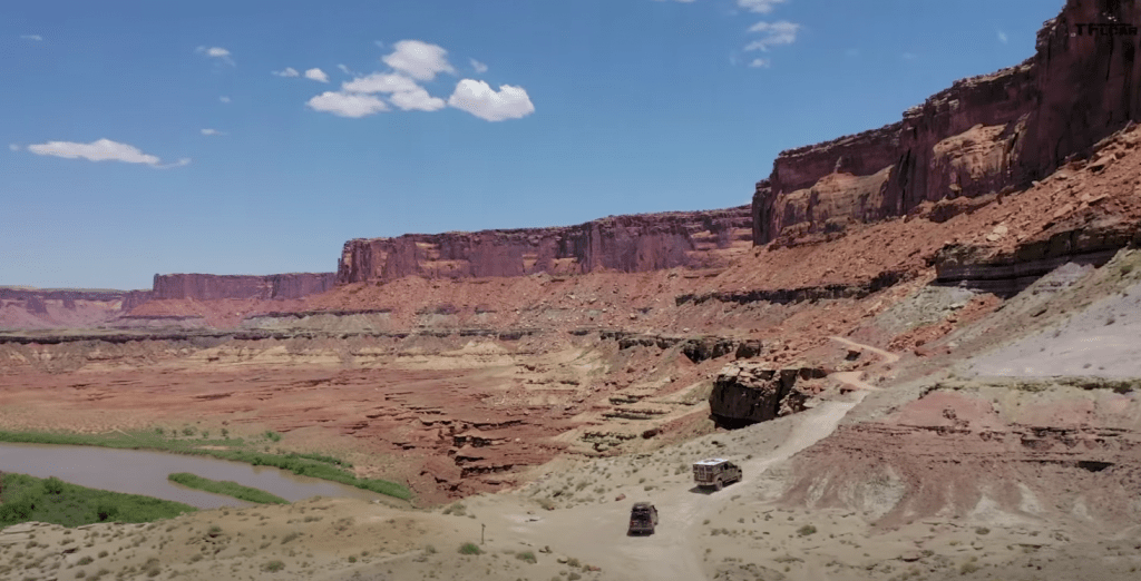
In this video, the team headed to the White Rim trail near Canyonlands National Park in southern Utah. The goal was an overnight shakedown trip for our No Pavement Needed overlanders, a 2020 Jeep Gladiator Rubicon tricked out with Mopar factory parts, and a 2020 Ford F-250 FX4 sporting a custom Carli Suspension lift and Four Wheel Camper camper in the bed. The White Rim loop is 92 miles of desert rock, sand, cliffs, heat, and emptiness. In other words, perfect.
On the way in, the app proved its worth immediately, helping guide the trucks to their reserved campsite deep inside canyon country at 11 p.m. on a moonless night. They discovered that they were miles down the wrong trail before they reached the point of no return.
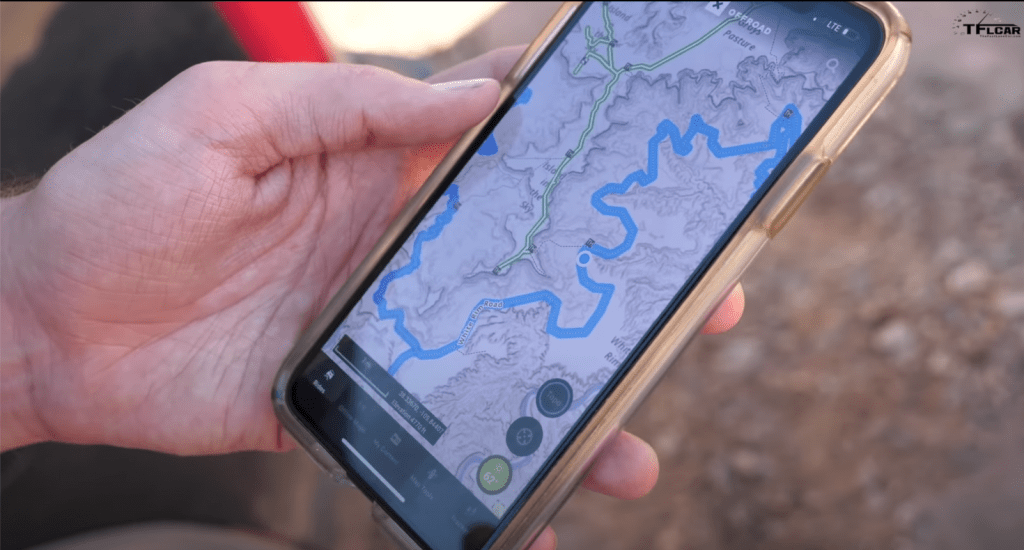
onX Offroad turns your phone into a feature-rich GPS
So how does it work? First you download the app, which cost $29.99 a year and get updated all the time. Once downloaded, you can then download your route by downloading preloaded sections of maps. In our case, this was a vast rectangle of southeastern Utah. Once the section is loaded, the app works with your iOS or Android phones internal GPS to geotarget your location on the map. Yep, no cell service required.
The routes and maps are uploaded at onX Offroad HQ in Missoula, Montana, based off of public lands information and local maps. A new initiative this year involves asking “Trail Guides” around the country to turn on the app while traversing their local roads and trails to build out the knowledge base even more. Users are asked to drop waypoints along the way with photos, calling out technical sections, scenic spots, or primo campgrounds from more than 54,000 listings. And speaking of campsites, the app lets you see and reserve spots ahead of time.
Plan your next big trip with onX Offroad today. Download now. Available in the Apple App Store or Google Play Store. Then click here to use promo code “TFL” and save 20% on an annual membership.
At the beginning of the year, the app charted more than 400,000 miles of roads and trails on more than 985 million acres of publicly accessible land. Updates and new routes appear daily. onX Offroad spits out critical information such as best time to go on the trail, whether the trail or road is open for the season, requires a permit or not, and what vehicles are allowed, and assigns a difficulty rating to each trail. Accordingly, you can search trails in an area by your vehicle type or rating, saving you from heading down a path that exceeds your capabilities.